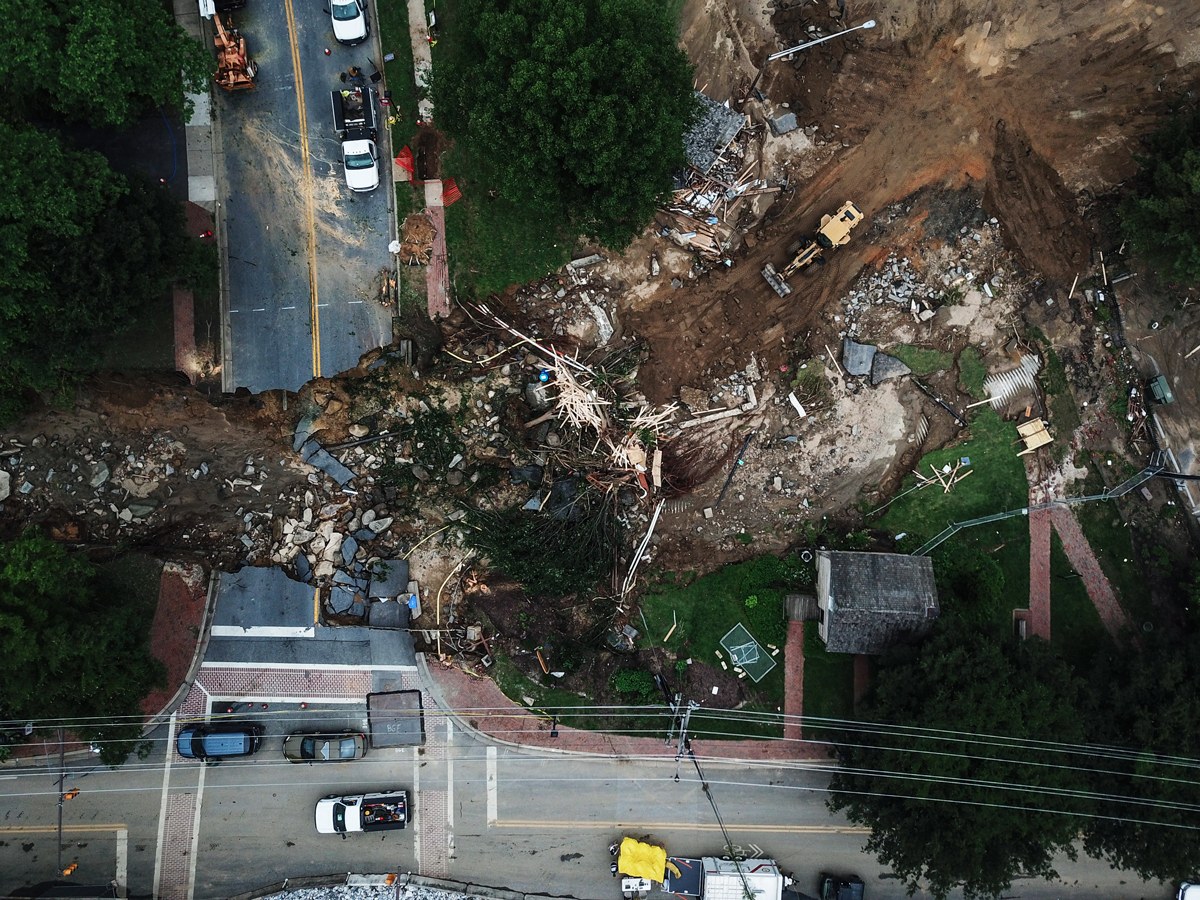
On May 27, a deluge dumped more than 6 inches of rain in less than three hours on Ellicott City, Maryland, killing one person and transforming Main Street into what looked like Class V river rapids, with cars tossed about like rubber ducks.
copyright by www.wired.com
 The National Weather Service put the probability of such a storm at once in 1,000 years. Yet, “it’s the second time it’s happened in the last three years,” says Jeff Allenby, director of conservation technology for Chesapeake Conservancy, an environmental group.
Floods are nothing new in Ellicott City, located where two tributaries join the Patapsco River. But Allenby says the floods are getting worse, as development covers what used to be the “natural sponge of a forest” with paved surfaces, rooftops, and lawns. Just days before the May 27 flood, the US Department of Homeland Security selected Ellicott City—on the basis of its 2016 flood—for a pilot program to deliver better flood warnings to residents via automated sensors.
Recently, Allenby developed another tool to help predict, plan, and prepare for future floods: a first-of-its-kind, high-resolution map showing what’s on the ground—buildings, pavement, trees, lawns—across 100,000 square miles from upstate New York to southern Virginia that drain into Chesapeake Bay. The map, generated from aerial imagery with the help of artificial intelligence, shows objects as small as 3 feet square, roughly 1,000 times more precise than the maps that flood planners previously used. To understand the difference, imagine trying to identify an Uber driver on a crowded city street using a map that can only display objects the size of a Walmart.
Creating the map consumed a year and cost $3.5 million, with help from Microsoft and the University of Vermont. Allenby’s team pored over aerial imagery, road maps, and zoning charts to establish rules, classify objects, and scrub errors. “As soon as we finished the first data set,” Allenby says, “everyone started asking ‘when are you going to do it again?’” to keep the map fresh.
Enter AI. Microsoft helped Allenby’s team train its AI for Earth algorithms to identify objects on its own. Even with a robust data set, training the algorithms wasn’t easy. The effort required regular “pixel peeping”—manually zooming in on objects to verify and amend the automated results. With each pass, the algorithm improved its ability to recognize waterways, trees, fields, roads, and buildings. As relevant new data become available, Chesapeake Conservancy plans to use its AI to refresh the map more frequently and easily than the initial labor-intensive multi-million dollar effort. […]
read more – copyright by www.wired.com


On May 27, a deluge dumped more than 6 inches of rain in less than three hours on Ellicott City, Maryland, killing one person and transforming Main Street into what looked like Class V river rapids, with cars tossed about like rubber ducks.
copyright by www.wired.com
Floods are nothing new in Ellicott City, located where two tributaries join the Patapsco River. But Allenby says the floods are getting worse, as development covers what used to be the “natural sponge of a forest” with paved surfaces, rooftops, and lawns. Just days before the May 27 flood, the US Department of Homeland Security selected Ellicott City—on the basis of its 2016 flood—for a pilot program to deliver better flood warnings to residents via automated sensors.
Recently, Allenby developed another tool to help predict, plan, and prepare for future floods: a first-of-its-kind, high-resolution map showing what’s on the ground—buildings, pavement, trees, lawns—across 100,000 square miles from upstate New York to southern Virginia that drain into Chesapeake Bay. The map, generated from aerial imagery with the help of artificial intelligence, shows objects as small as 3 feet square, roughly 1,000 times more precise than the maps that flood planners previously used. To understand the difference, imagine trying to identify an Uber driver on a crowded city street using a map that can only display objects the size of a Walmart.
Creating the map consumed a year and cost $3.5 million, with help from Microsoft and the University of Vermont. Allenby’s team pored over aerial imagery, road maps, and zoning charts to establish rules, classify objects, and scrub errors. “As soon as we finished the first data set,” Allenby says, “everyone started asking ‘when are you going to do it again?’” to keep the map fresh.
Enter AI. Microsoft helped Allenby’s team train its AI for Earth algorithms to identify objects on its own. Even with a robust data set, training the algorithms wasn’t easy. The effort required regular “pixel peeping”—manually zooming in on objects to verify and amend the automated results. With each pass, the algorithm improved its ability to recognize waterways, trees, fields, roads, and buildings. As relevant new data become available, Chesapeake Conservancy plans to use its AI to refresh the map more frequently and easily than the initial labor-intensive multi-million dollar effort. […]
read more – copyright by www.wired.com
Share this: